
A Nature Sustainability paper argues coastal Louisiana has crossed a point of no return. A plain reading of what it claims, the state decisions behind the outlook, the New Orleanians answering back, and how the city fits a national coastal picture.
By Kim M. Braud | Evans Cutchmore | July 08, 2026
In early May, the Guardian reported that coastal Louisiana has reached what researchers call a point of no return, and that planning to move people out of the New Orleans region should begin now. The piece drew on a new academic paper and traveled quickly, forwarded, as one local writer noted, both out of genuine concern and as validation by people who have already left.
Because the study makes a sweeping claim about the future of a city many of us call home, it is worth separating what the research says from how it circulated.
What the study argues
The central claim comes from a perspectives paper in the journal Nature Sustainability, co-authored by five researchers including Jesse Keenan, a climate adaptation expert at Tulane University. A perspectives paper is a scholarly assessment rather than a presentation of new data, a distinction the Guardian noted and one worth holding onto.
The paper projects that southern Louisiana faces 3 to 7 meters of sea level rise and the loss of roughly three-quarters of its remaining coastal wetlands, which it estimates could push the shoreline as much as 62 miles inland and strand both New Orleans and Baton Rouge. It describes the region as the most physically vulnerable coastal zone in the world. Its recommendation is managed retreat: a coordinated, government-led effort to move residents to safer ground, beginning with the most exposed communities, such as those in Plaquemines Parish who live outside the levee system.
Keenan supplied the framing that anchored much of the coverage, describing the city as being in terminal condition and arguing the state should manage a planned transition rather than avoid the diagnosis. He put the planning window at likely decades rather than centuries, and said that even if global heating stopped today, a city sitting below sea level and surrounded by open water could not be kept afloat indefinitely.
One headline, two studies
A point of precision for anyone citing the piece. The relocation argument and a widely shared statistic come from two different studies.
The managed-retreat thesis is the Nature Sustainability paper. The separate and striking claim that 99 percent of the New Orleans population faces major flood risk, the highest exposure of any US city, comes from a different study released the week before, co-authored by University of Alabama geographer Wanyun Shao. Both point the same direction, but they are not the same research, and readers frequently merge them.
The policy decisions underneath the science
The strongest part of the Guardian's reporting is that it does not treat the outlook as purely natural. It links the projection to specific, recent choices by the state.
Louisiana's coastal strategy had shifted toward using the Mississippi River's own sediment to rebuild land. The Mid-Barataria Sediment Diversion, funded through the BP settlement over the 2010 Deepwater Horizon disaster, broke ground in 2023 and was projected to build more than 20 square miles of new land over 50 years. In 2025, Governor Jeff Landry halted the project, citing its roughly $3 billion cost and the risk to the fishing industry. Garret Graves, a Republican former congressman who once led the state's coastal agency, called the cancellation a serious setback for the coast. The paper's authors wrote that abandoning the diversion effectively means giving up on large portions of coastal Louisiana, including the New Orleans area.
A parallel effort to make oil and gas companies pay for wetland damage is also uncertain. This spring, the US Supreme Court allowed the industry to contest, in federal court, a state jury's decision that Chevron pay $740 million for coastal harm. Landry's office did not respond to the Guardian's request for comment.
For scale: since the 1930s Louisiana has lost about 2,000 square miles of coast, roughly the size of Delaware, with another 3,000 square miles projected to disappear over the next 50 years.
Who was not in the conversation
The study and the coverage around it were sourced almost entirely to scientists and elected officials. Residents of the communities named for relocation did not appear in the article. That absence became the center of the local response.
Writing in The Lens, Christopher Ard, an 11th-generation New Orleanian, argued that outside writers produce a near-annual obituary for the city, and that the language of relocation lands, for people who live here, as a call to abandon their home. He described the framing as "a modern day redlining of an entire city" and suggested the more useful question is what keeps New Orleans viable longer, rather than how to leave it.
Shao, one of the researchers, acknowledged the difficulty directly, noting that the subject is politically and emotionally charged and that many people hold a deep attachment to the city, while maintaining that in her assessment managed retreat is the eventual outcome.
Why it matters here
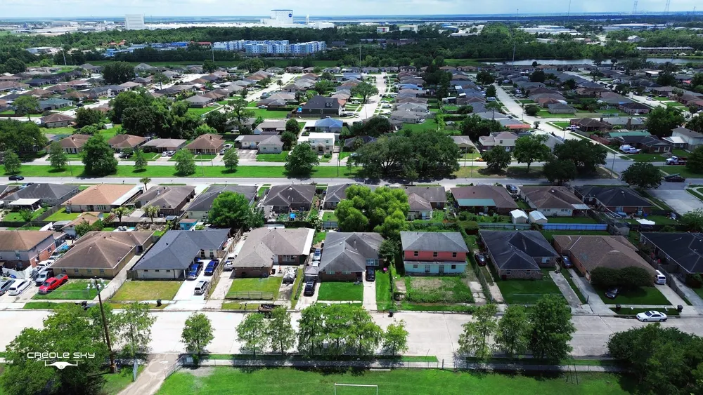
New Orleans sits in a bowl below sea level and depends on the levees, floodgates, and pumps built and rebuilt after Hurricane Katrina. The paper's warning is that this system, already in need of costly upgrades, cannot hold indefinitely, and that without continued land-building the levees will be overtopped again. For neighborhoods along the Industrial Canal and in the Lower Ninth Ward, that is not an abstraction. It is the failure they lived through in 2005.
New Orleans is not the only coast facing this
The study frames southern Louisiana as the most physically vulnerable coastal zone in the world. The forces behind that vulnerability, rising seas combined with sinking land, are not unique to Louisiana, and the federal data place New Orleans within a national pattern rather than outside it.
The 2022 Sea Level Rise Technical Report, produced by NOAA, NASA, and other federal agencies, projects that the average US coastline will see 10 to 12 inches of sea level rise by 2050, about as much as it recorded over the entire last century, with the exact amount varying by region largely because of how much the land itself is settling. NOAA reports that high-tide flooding, the sunny-day flooding that arrives without a storm, is already 300 to more than 900 percent more frequent than it was 50 years ago, and that 34 coastal locations broke or tied their flood-day records in 2023 alone, up from eight the year before.
The cities carrying that risk map onto the eastern and Gulf seaboard. NOAA's own analysis flags Norfolk, where the land is sinking around one of the country's largest naval bases, along with Boston, New York, Philadelphia, Baltimore, Washington, and Wilmington, North Carolina, as approaching or already crossing a nuisance-flooding threshold. Charleston and Annapolis already see routine tidal flooding in low-lying areas. In Texas, groundwater and fossil-fuel withdrawal have driven the land down beneath Houston and Galveston Bay. South Florida faces saltwater pushing into the aquifers that supply its drinking water. The Jersey shore and Lower Manhattan are still absorbing the lessons of Superstorm Sandy. The federal data show the fastest rates of US sea level rise along the Gulf from the mouth of the Mississippi westward, followed by the mid-Atlantic, which places Louisiana at the leading edge of a curve that many other states are on.
None of this lessens the severity of Louisiana's situation, which the federal data rank among the most acute in the nation. It does place it in company. The choices the paper raises for New Orleans, whether to fortify, to rebuild land, or to move people, are the same categories of choice now reaching Norfolk, Charleston, Miami, and Houston.
How to follow this
Coastal and flood decisions in Louisiana are made in public, and residents can weigh in.
The state's coastal strategy runs through the Coastal Protection and Restoration Authority, which develops and periodically updates Louisiana's Coastal Master Plan and takes public comment on it. The future of sediment diversion and land-building policy will be decided there and in the Legislature.
Local flood protection is overseen by the Southeast Louisiana Flood Protection Authority-East, whose board meetings are open to the public.
Evans Cutchmore will continue to track the Coastal Master Plan process, the status of the Mid-Barataria project, and the Chevron litigation as they move.
Kim M. Braud is the Founder & Editor of Evans Cutchmore, an independent newsroom covering Louisiana and the Gulf South. Her reporting focuses on government accountability, infrastructure, business, culture, and the public policies that shape communities. Her work combines investigative journalism, public records research, and documentary storytelling.
© 2026 Evans Cutchmore Press. All rights reserved.